Banner

Banner

Tuesday, September 25, 2018

Kiss Your Ash Goodbye: The Yellowstone Supervolcano, Part III, A Vulcanology Primer


By Stephanie Osborn
Images in this article are public domain unless otherwise noted.

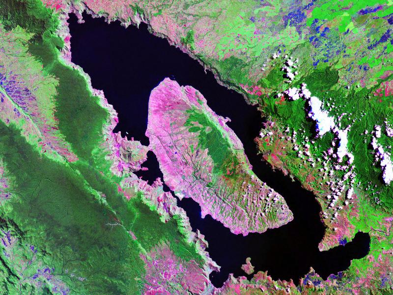
The Yellowstone Hotspot and Structure

NOTE: I am aware that there is current research claiming that the subducted Farallon Plate is the source of the Yellowstone melt, as well as its long-lived behavior and track. However, based on what I know, I am skeptical.

For now, in the absence of more definitive results, and given the fact that the ancient plate is now pretty much crammed almost as far under the eastern North American plate as it can get and still be under it, and given detailed information on a mantle plume of some substantial size, it is my considered opinion that more than likely, the Farallon Plate had only marginal, if any, effects on Yellowstone. That said, it may possibly be at least part of the reason why said mantle plume is anything but vertical. (I do discuss all this in a bit more detail in the ebook.)

I also note that the current accepted model is “mantle hotspot,” with plenty of data to support it. If that should change, I will add an update.

Overview

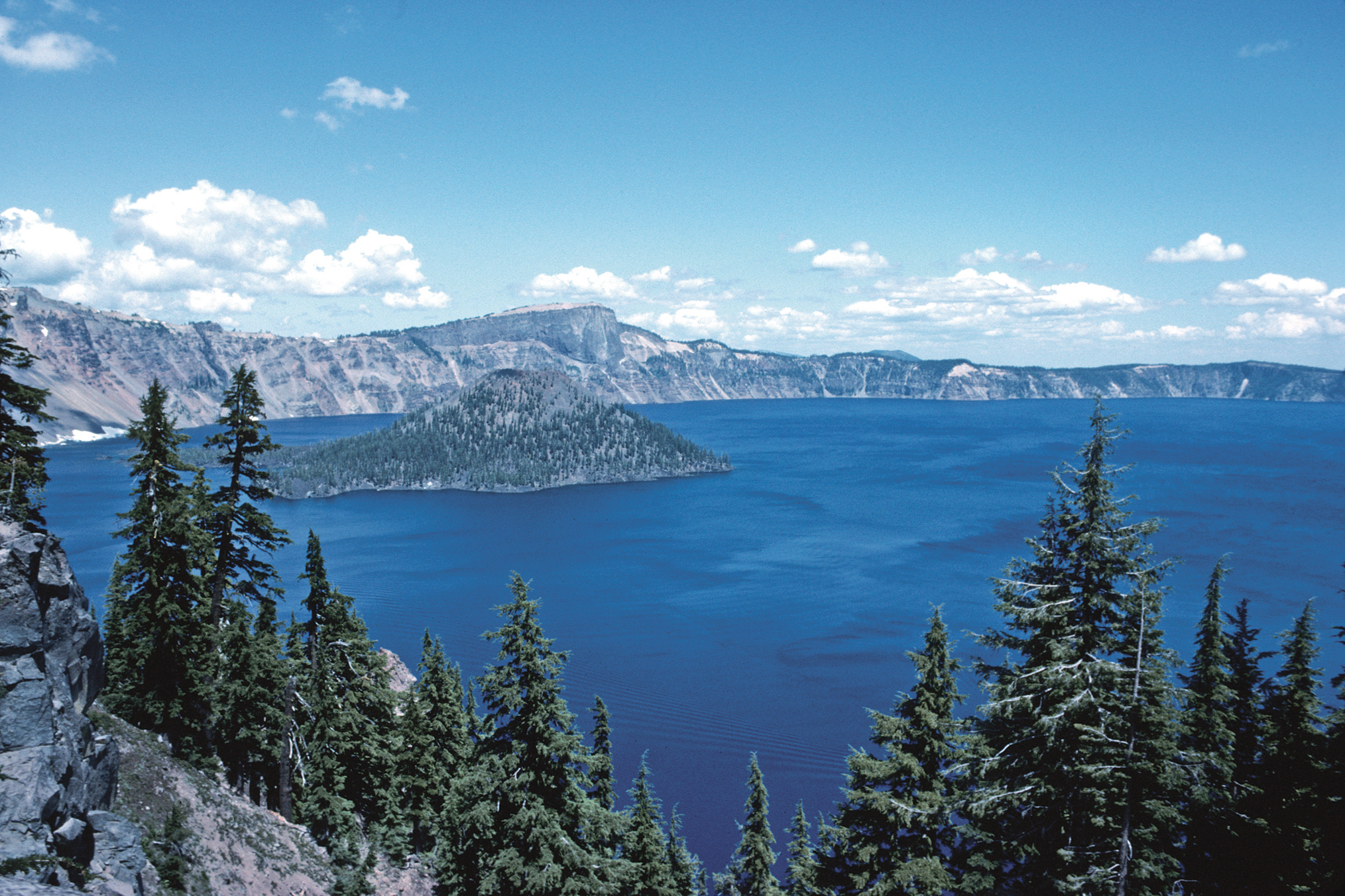
The Yellowstone supervolcano is a very long-lived system. Unlike most more ordinary volcanoes, which are supplied with magma via such relatively shallow means as tectonic plate subduction and subsequent melting, Yellowstone is apparently produced by a large and powerful mantle plume; the reason for the plume is unknown. As the melt in the plume rises, it pushes on the overlying crust, “puddling” in a weakness in the overlying rock, forming a magma chamber. This pressure first forms a bulge (a “dome”), then the crust of the bulge begins to crack (surface cracks). If these cracks deepen enough to reach the magma chamber, an eruption can occur. They are also responsible for the hydrothermal features seen in the national park.

The Plume

The mantle plume goes down at least 600mi (~966km), but recent seismic evidence discovered by researchers at the University of Texas indicates it may go as far down as the outer core/mantle boundary, some 1,800mi (~2,900km) down. The plume apparently angles sharply south-southwest from the megacaldera, and the base of the plume can be found under the California/Mexico border. It is very roughly cylindrical; early estimates indicated it was some 215-300mi (346-483km) in diameter, but more recent estimates say it is at least 400mi (644km) wide. It is 2,050mi (3,300km) long, and up to 1,500ºF (816ºC) at the base, near the core.

The Magma Chambers

There are a couple of different reconstructions from seismic & other data that indicate the possible shape & size of the magma chamber. More, seismic tomography indicates there are TWO, a shallow and a deep chamber, with the deep chamber likely directly linked to the mantle plume.


The deep magma chamber, connected to the upper mantle plume.
Note state lines and park/caldera outlines on top and bottom of cube, for scale.

According to the USGS, “The shallower magma storage region is about 90km (56mi) long, [and] extends from 5-17km (3-10.5mi) depth.”

In turn, and from the same source, “The deeper magma storage region extends from 20-50km (12-31mi) depth, contains about 2% melt, and is about 4.5 times larger than the shallow magma body.”
If we assume based on those measurements average values for length, width, and height, such that the smaller chamber is a rough prolate ellipsoid of approximate dimension 7.5x7.5x56mi (12x12x90km), then it has a rough volume of ~13,000cu. mi. (~54,000km3). This then gives a volume for the deeper chamber of 58,500cu. mi. (~244,000km3).

However, as it turns out, generally speaking, magma chambers don’t induce eruption until they have surpassed the 50%-full mark. And that’s a whole heck of a lot of magma, AND we’re only at 2%. On general principles, I think we’re good.

The Geysers/Hydrothermal Features

The geysers, hot springs, mud pots, fumaroles, and the like are fed by ancient rain- and meltwaters — the local ground water, in essence, except it is often coming from depth — that seep through the network of cracks and fractures in the rock. They are heated by the chambers and gradually rise, eventually forcing their way to the surface to form geysers and all the other hydrothermal features common to Yellowstone and other such similar volcanic landscapes.


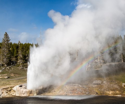
Riverside Geyser. Credit: National Park Service.


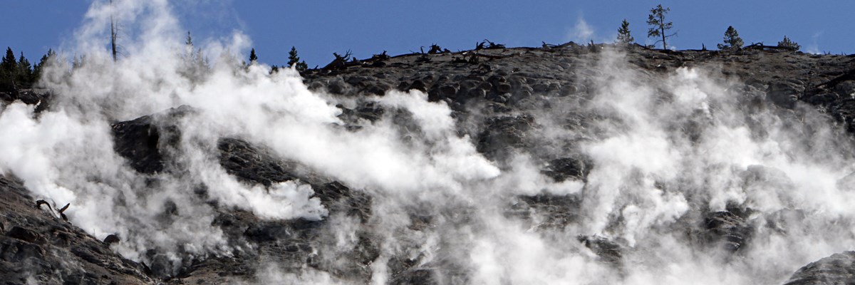
A fumarole (steam vent) field in Yellowstone, where dangerously superheated steam emerges in the geyser basins. Credit: National Park Service /Jim Peaco

WARNING: most of the hydrothermal features in Yellowstone, and other active megacalderas, are DANGEROUSLY HOT. Not infrequently, these are superheated waters, meaning their temperatures may well be above the boiling temperature of water; this is especially true for geysers and fumaroles, but many — most — hot springs are also near boiling. More, at least at Yellowstone, they also are prone to being highly acidic. It is NOT AN EXAGGERATION in the least to say that entering one of these features means an instant, horrible death; it has happened many times. Worse, sometimes bodies are not recovered, simply because the water has become strongly acidic thanks to the sulfuric gases dissolved in it; the corpses simply dissolve. When the bodies are recovered, they are often in very poor condition. DO NOT EVEN THINK OF TRYING to use one as your personal hot tub, and DO NOT LEAVE THE TRAILS/WALKWAYS, because the high mineral content can form what LOOKS like solid ground, but is really a skim of mineral deposits floating on the water’s surface.

Is There Any Danger of Eruption?

Yes, because this is an active volcanic feature; there has been some uplift in areas of the park, especially under the lake, but given the nature of the feature, and the high levels of seismic activity that occur there normally, that isn’t necessarily anything to worry about. The “uplift” feature on the lake floor seems to be part of an underwater field of hydrothermal vents, fissures and faults, not unlike those found on ocean floors, so it is likely that the uplift is a result of gases and expanding hot water underneath. Certainly a good deal of the seismic activity in and around the caldera has to do with this same hydrothermal activity; this expansion, when the water is in the natural cracks of a rock stratum, will force the cracks wider until the stone eventually breaks. This fracture does create small quakes.

So-called “quake swarms” in the region are NOT in the correct area to indicate magma on the move. They also don’t have the “long-period harmonic” vibrational component to indicate flowing magma. More, detailed geophysical studies show no evidence of either magma chamber inflating.

To obtain a copy of Kiss Your Ash Goodbye: The Yellowstone Supervolcano by Stephanie Osborn, go to: bit.ly/Kin-KYAGTYSV.

Tuesday, September 18, 2018

Kiss Your Ash Goodbye: The Yellowstone Supervolcano, Part II, A Vulcanology Primer


By Stephanie Osborn
Images in this article are public domain unless otherwise noted.

 How many supervolcanoes are there in North America?

There are ~170 active volcanos in the United States of America, most in Alaska and Hawaii, though there are quite a few along the West Coast states.

There are only an estimated 4-5 supervolcanoes in the USA. These include the Yellowstone Caldera (VEI:7-8), Mt. Mazama/Crater Lake (considered dormant) (VEI:7), Valles Caldera (VEI:7), Long Valley Caldera (VEI:7), La Garita Caldera (likely extinct) (VEI:8), with all except the last potentially capable of erupting. There were more, but they appear to be extinct. Extinct is relative, however; most show some degree of geothermal activity in the area.

Mt. Mazama/Crater Lake (VEI:7)

The central feature of Crater Lake National Park is Mount Mazama in southern Oregon. It is a composite volcano (a composite of alternating layers of ash/cinder and lava) in the Cascade Volcanic Range of the Pacific Northwest, which are fed by the subduction and subsequent melting of the Pacific Ocean floor tectonic plates.

Prior to the caldera-forming eruption, Mazama stood at least ~12,000ft (3,700m) in altitude. Post-eruption, it now has a maximum height of 8,934ft (2,723m) at Mount Scott (2mi/3km east of the caldera rim), which is a parasitic cone on the flank of the volcano. [Yes, that’s right, the caldera rim is some 800ft+ (240m+) lower.]

The caldera rim proper ranges from 7,000-8,000ft (2,100-2,400m) altitude, and is 5x6mi (8.0x9.7km) across. The bottom of Crater Lake goes 2,148ft (655m) down; it is the deepest lake in the U.S. The lake IS the caldera, so that's at least how far it collapsed. Some say that the bottom is near the base of the mountain, others that it goes even deeper.


Crater Lake, the water-filled caldera of Mt. Mazama.

In relatively continuous eruption since 420,000 years ago, things changed around 30,000 years ago, when the chemistry of the melt feeding the magma chamber apparently began to change from a relatively basaltic, runny magma to a much more viscous, silica-rich melt. As this melt grew thicker, the eruptions became more violent.

The catastrophic eruption occurred 7,700 years ago, and was observed by the local Klamath indigenous people, who “recorded” it in myth. It “...started from a single vent on the northeast side of the volcano as a towering column of pumice and ash that reached some 30mi (50km) high. Winds carried the ash across much of the Pacific Northwest and parts of southern Canada...As the summit collapsed, circular cracks opened up around the peak. More magma erupted through these cracks to race down the slopes as pyroclastic flows. Deposits from these flows partially filled the valleys around Mount Mazama with up to 300ft (100m) of pumice and ash. As more magma erupted, the collapse progressed until the dust settled to reveal a caldera, 5mi (8km) in diameter and 1mi (1.6km) deep.” ~USGS website

Subsequent eruptions from vents inside the caldera created what became Wizard Island, as snow- and glacier-melt slowly filled the depression. Eventually eruption ceased, and the ruins of Mt. Mazama began to resemble the beautiful Crater Lake we know today.

Mt. Mazama is officially considered dormant by the U.S. Geological Society.

The Valles Caldera (VEI:7)

Sometimes called the Jimez Caldera, this supervolcano is located in northern New Mexico, 55mi (90km) north of Albuquerque. It is named for the numerous grassland valleys (Spanish: valles) contained within the circular caldera, which is about 13.7mi (22km) in diameter. It is similar to Yellowstone in that the caldera also contains hot springs, fumaroles (steam vents), gas vents, and volcanic domes, in addition to meadows and streams.


The Valles Caldera as viewed from the rim. 
Note the volcanic domes dotting the floor.
Credit: National Parks Service.

Geologically, it is one of the best-studied calderas in the U.S. There are at least two known calderas on this site, the Valles, and the older Toledo Caldera. The nearby and associated Cerros del Rio volcanic field is older still, indicating multiple supereruptions at this site. Overall, these and related nearby volcanic features are included within the Jemez Volcanic Field & Mountain Range, which stretches across three counties in New Mexico.

Several layers of silica-rich lava and tuff (welded ash) in the region are ample proof of the eruptions, the most recent of which was some 50-60 thousand years ago and resulted in the current Valles caldera. Previous eruptions date back at least 14 million years.

The cause of the vulcanism seems to be the intersection of the Rio Grande Rift (a continental rift zone, running N-S from central Colorado state, USA, to Chihuahua state, Mexico) and the Jemez Lineament (a series of faults running E-W 600mi (965km) from Arizona east possibly as far as western Oklahoma). The Valles Caldera does not, therefore, appear to be due to a solitary mantle hotspot as such, but to rifting occurring in the middle of the continental plate, though this rifting may be from convective uplift in the mantle.

The Long Valley Caldera (VEI:7)

The Long Valley Caldera is in central California along and slightly east of the westernmost Sierra Nevada Range. It and the adjacent Mammoth Mountain/Mono-Inyo complex are around 55mi (89km) northeast of Fresno, California.


Part of the Long Valley Caldera, 
looking east from the north rim.

The caldera is ~20mi (32km) long, 10mi (16km) wide, and up to 3,000ft (910m) deep. It generated a massive supereruption some 760,000 years ago, producing the Bishop Tuff formation. The grand total of ejecta was some 150cu.mi (625km3), after which the surface sank nearly a mile (1.6km) into what had been the magma chamber.

The cause of the supereruption is unexplained; it is not fueled by a mantle hotspot, nor is it provided melt via subduction.

More, while it is adjacent to still-active Mammoth Mountain and the Mono-Inyo crater chain, and at least appears to be associated with them, the magma chemistries are very different, indicating they do not share a common melt system, and are NOT associated. This is an interesting puzzle.

“The caldera remains thermally active, with many hot springs and fumaroles, and has had significant deformation, seismicity, and other unrest in recent years.” ~USGS website

The activity is sufficient to run a geothermal power plant located there. But how much of this activity is due to the Mono/Mammoth complex and how much to the caldera source is not fully understood. Smaller eruptions have occurred around the caldera on a semi-regular long period, but the lava extruded has apparently been increasingly crystalline in nature, which may indicate that the magma source is cooling significantly.

La Garita/Creede Caldera (VEI:8)

The La Garita caldera-forming eruption is estimated as one of the largest eruptions on Earth. It lies in the midst of a huge region in the Rocky Mountains called the San Juan Volcanic Fields. The town of Creede sits on what would have been the north caldera rim, with Pueblo, Colorado 110-115mi (km) east-northeast; Colorado Springs ~120mi (193km) northeast; Denver ~150mi (240km) north-northeast.

This region became active some 35-40 million years ago, with an exceptional period of activity from 30-35 million years ago. At the tail end of this flurry of vulcanism, the La Garita supereruption took place, roughly 27 million years ago. It ejected some 1,200cu.mi. (5,000km3) of material, which became known as the Fish Canyon Tuff. This ash deposit covered an area of AT LEAST 11,000 sq.mi. (30,000km2) in a layer whose average depth was 328ft (100m). This tuff is surprisingly uniform chemically, indicating it was ejected all in a volume.

The resulting caldera was a monster 22mi (35km) wide, and anywhere from 47-62mi (75-100km) long. It is no longer recognizable as such to the untrained eye, however, as a single resurgent dome (Snowshoe Mountain) has filled it.


La Garita Caldera (red dotted outline), 
with resurgent dome (Snowshoe Mountain) inside it. 

The energy of the eruption was some 5,000x the largest nuclear device ever detonated on Earth, the Tsar Bomba, a 50MT explosive. This places the La Garita supereruption at 250 GIGATONS of energy. The area devastated would have encompassed a substantial portion of what is modern-day Colorado, not counting ash fall.

Vulcanism in the San Juan Volcanic Field as a whole, including the La Garita supervolcano, apparently ended 2.5 million years ago. It is considered extinct.

What’s the strongest supervolcano ever known?

The biggest known eruption in geologic history IN THE USA — some say in the world — was the Fish Canyon eruption in the La Garita megacaldera.
The biggest known eruption in geologic history in the WORLD was the Guarapuava-Tamarana-Sarusas eruption in South America. The eruption occurred ~132 million years ago, produced an estimated 2,100 cu. mi. (8,600 km3) of ejecta, and was probably at least the equivalent of the La Garita eruption.

To obtain a copy of Kiss Your Ash Goodbye: The Yellowstone Supervolcano by Stephanie Osborn, go to: http://bit.ly/Kin-KYAGTYSV.

Tuesday, September 11, 2018

Kiss Your Ash Goodbye: The Yellowstone Supervolcano, Part I, A Vulcanology Primer


By Stephanie Osborn
Images in this article are public domain unless otherwise noted.

What is a supervolcano?

“The term ‘supervolcano’ implies a volcanic center that has had an eruption of magnitude 8 on the Volcanic Explosivity Index (VEI), meaning the measured deposits for that eruption is greater than 1,000 cubic kilometers (240 cubic miles).” ~U.S. Geological Survey

That said, often volcanic eruptions with a slightly lesser VEI of 7 are also considered supervolcanic. This is because the VEI does not take density of ejecta into account. Magma chemical composition varies, depending upon the source of the melt. This can produce lava with varying densities.


Crater Lake, in Mount Mazama, with Wizard Island cinder cone.


What is the Volcanic Explosivity Index?

It is a means of ranking a volcanic eruption, similar to the Richter or moment magnitude scales for earthquakes. According to the U.S. Geological Survey, “The Volcanic Explosivity Index (VEI) is a relative measure of the explosiveness of volcanic eruptions. It was devised by Chris Newhall of the United States Geological Survey and Stephen Self at the University of Hawaii in 1982.” It categorizes eruption characteristics, such as volume of ejecta, eruption cloud height, etc. Again quoting the USGS, “The scale is open-ended with the largest volcanic eruptions in history (super-eruptions) given magnitude 8.” Since it is open-ended, some geologists do estimate that a very small number of eruptions in geologic history may have reached a 9, though such a rating is currently unofficial.


The Volcanic Explosivity Index.

Are all supervolcanoes explosive?

NO.

There are supervolcanoes known as “traps” which tend to be nonexplosive. These are typically long cracks — sometimes fields of parallel cracks — from which vast quantities of lava (“flood basalts”) flow over the surrounding terrain. The term refers to the step-like terrain common to such features. One of the best known in the geological community were the Deccan Traps. This eruption occurred some 60 million years ago in the Deccan Plateau region of what is now India. The residual lava beds originally may have covered some 580,000sq.mi. (1.5million km²) more than 2x the size of Texas. Multiple flows over time covered the area in ~6,600ft (2,000m) thick basalts. It is one of the largest volcanic features on Earth.

How strong is a supervolcano?

That depends on the type of supervolcano and your definition of “strong.” There are two types of supervolcano:

1) Megacalderas, or “massive eruptions”:
These are cliff-edged craters, usually (though not always) NOT surrounded by a mountain, where the violence of the eruption emptied the magma chamber. The overburden collapsed into the chamber, leaving a sinkhole-like depression.


Lake Toba — the lake IS the caldera.

2) Traps, or Large Igneous Provinces:
As already mentioned, these are huge regions of lava flow resulting from flood basalt eruptions, often hundreds or thousands of square miles with volumes on order of millions of cubic miles. The lavas are normally laid down in sequential eruptions over millions of years.


Siberian Traps lava flow.
Image credit Benjamin Black via USGS.


While traps are considered supervolcanoes, usually it is the megacaldera which is being referenced, due to its violence.

What is the difference between traps and megacalderas?

Traps tend to be effusive and megacalderas tend to be eruptive. This is not always true but usually is. The difference lies in the chemistry of the melt.

Effusive flows tend to have thin, runny lava (low viscosity), usually basaltic in composition. Dissolved gases escape quickly. This produces dramatic lava fountains and swift flows. Example: Kilauea.

Eruptive flows tend to have thick, viscous lava (high viscosity), usually granitic in composition. Dissolved gases are held in the melt.  Pressure builds, and an eruption ensues when the containment (volcanic vent/neck/chamber) fails. Example: Mt. St. Helens.

If the melt chemistry changes for any reason, a trap can become eruptive, or a megacaldera can become effusive, at least temporarily.

How strong is a supervolcano? (Take two)

When Mt. St. Helens erupted, it released thermal energy equivalent to approximately 24 megatons (MT). 7 MT of this was expended in the blast alone. The St. Helens eruption was a VEI 5.

As previously mentioned, the Volcano Explosivity Index is logarithmic. A supervolcano eruption is VEI 7-8. This is 2-3 orders of magnitude stronger than St. Helens. A supervolcano, therefore, would release an estimated 2,400-24,000 MT (2.4-24 gigatons (GT)) of thermal energy. If we scale the blast size up proportionally, this would result in a blast equivalent to approximately 700 MT to 7 GT.

How many supervolcanoes exist?

That depends on who you talk to, and what criteria they are using. Some say as few as half a dozen, others as many as 20 or more.

Keep in mind, there may also be ocean-floor volcanos of which we’re unaware.

A Partial List of Known Active/Dormant Supervolcanoes Currently In Existence

• Aira Caldera/Sakurajima, Kagoshima, Japan
• Baekdu Mountain, China/North Korea border
• Campi Flegri/Phlegraean Fields, Naples, Italy
• Cerro Galan Caldera, Catamarca province, Argentina
• Kurile Lake/Kurilskoye Lake, Kamchatka, Russia
• La Pacana, Zapaleri tripoint, Chile/Bolivia/Argentina
• Lake Toba, North Sumatra, Indonesia
• Long Valley Caldera, Mammoth Mountain, California, USA (south of Mono Lake)
• Macauley Island, New Zealand
• Mount Aso, Kumamoto Prefecture, Japan
• Tambora, Sumbawa, Indonesia
• Taupo Caldera, North Island, New Zealand
• Thera/Santorini, Santorini, Greece
• Valles Caldera, Santa Fe, New Mexico, USA
• Yellowstone Caldera, Yellowstone National Park, Wyoming, USA

To obtain a copy of Kiss Your Ash Goodbye: The Yellowstone Supervolcano by Stephanie Osborn, go to: http://bit.ly/Kin-KYAGTYSV.